
Terrain modelling in Nuremberg
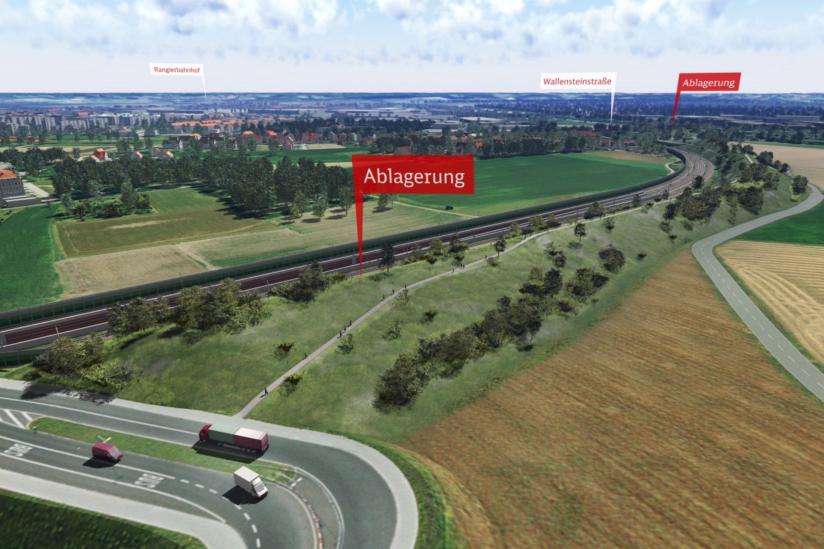
Every tunnel involves a large volume of spoil. In the case of the Pegnitz tunnel, it is intended to use the spoil from the southern trough, the southern cut-and-cover section and the TBM drive for terrain modelling on the Wallensteinstrasse and the Uffenheimer Strasse. Both terrain models will be designed to comply with environmental and acoustic criteria and be largely accessible as recreational areas with a view. In particular, terrain modelling along the Uffenheimer Strasse will fulfil an important noise protection function for Tiefes Feld which a noise protection barrier alone could not do. Fourfold benefit will thus be achieved in the form of protection against noise, terrain modelling, compensation for effects on the environment and local recreation.
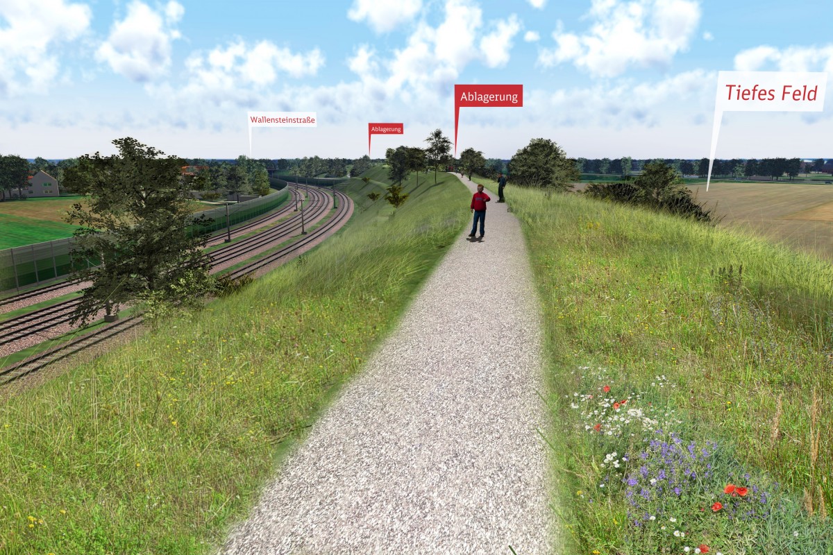
The Uffenheimer Strasse terrain model will rise to a height of 11 – 12 metres above current ground level. It will extend from the junction with Hügelstrasse to Rothenburger Strasse. Uffenheimer Strasse, classified as a field and woodland path, will be completely relaid at the foot of the terrain model on the Tiefes Feld side and continuously surfaced with asphalt. Footpaths and compensatory planting are planned on the terrain model, within the scope of environmental compatibility planning. It will be possible to look out over the landscape, across Tiefes Feld, Höfen and Grossreuth. The responsible agencies, particularly the Nuremberg Town Planning Department, will be involved in the agreements.
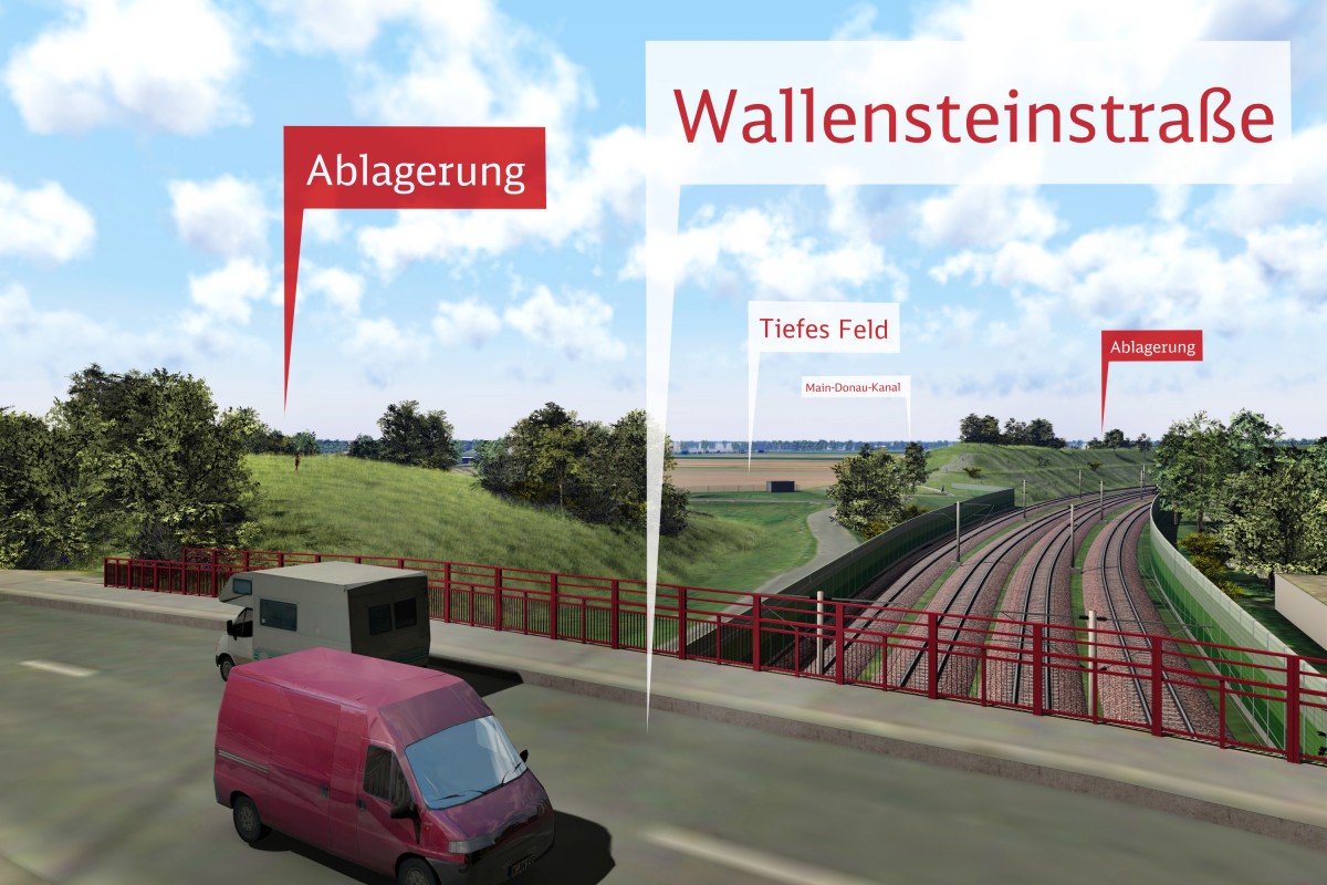
Further terrain modelling is intended between Wallensteinstrasse and Hügelstrasse, but on a smaller scale. It will also be greened and publicly accessible. It will also perform a noise protection function, in addition to the noise protection barrier on the Uffenheimer Strasse (below the Wallensteinstrasse bridge).